Offroad & Overland Navigation
Navigation built for the trail, not the highway.
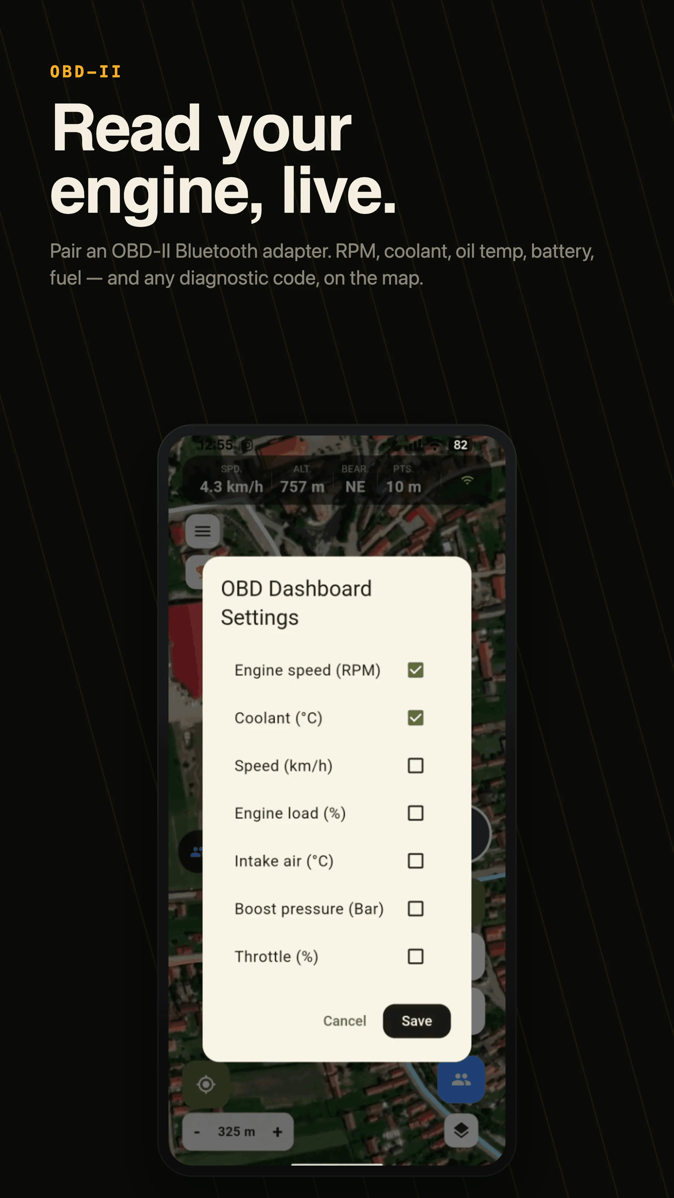
DirtMap keeps your maps, GPS tracks, convoy, 3D replay and vehicle tools in one rugged app — and it keeps working where the pavement and the signal end.
Free to start · Premium with a 14-day free trial
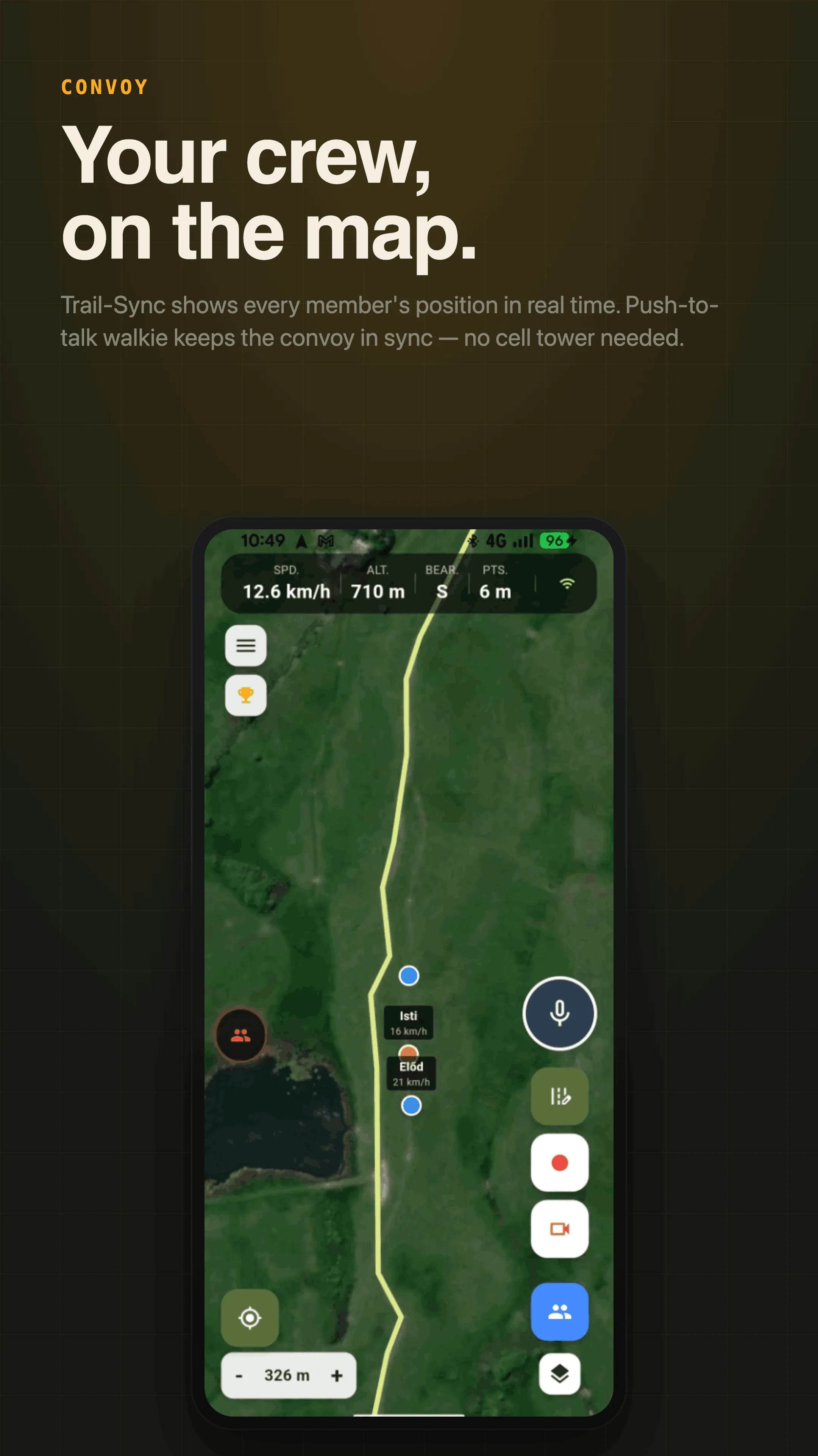
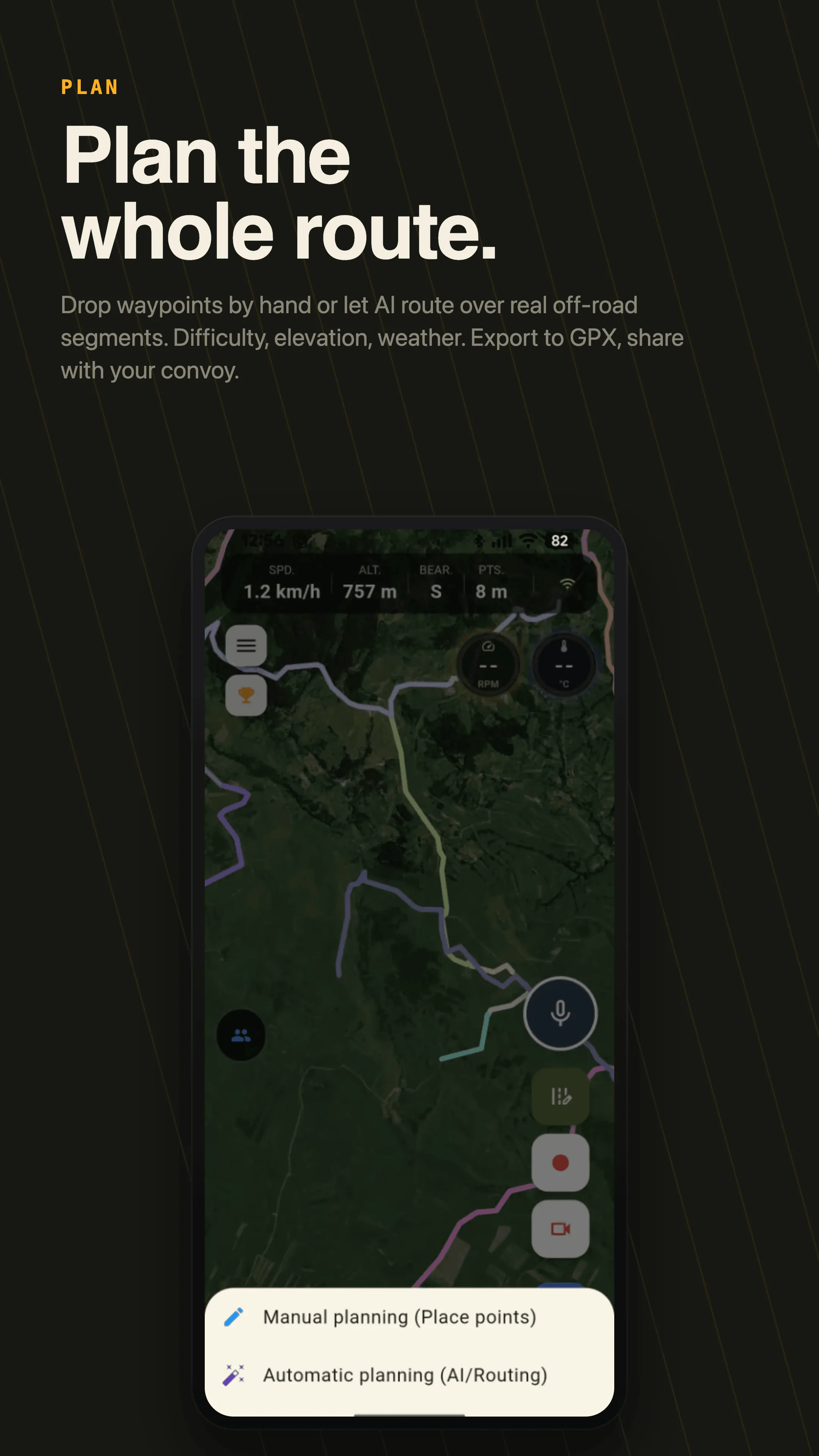
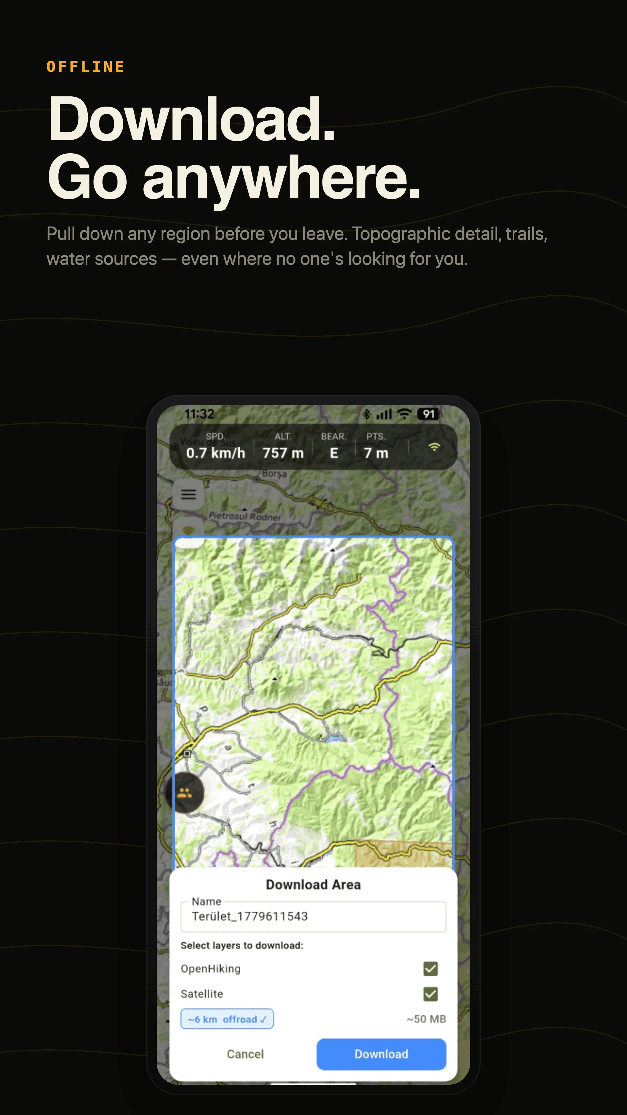
Everything you need off the grid
One app for planning, recording, riding together and getting home.
New · Android Auto
The map on your car screen
Offline 3D maps, turn-by-turn guidance on your saved routes, live convoy and OBD gauges — right on the head unit. It starts with the car even if the phone stays in your pocket, and follows day and night automatically. CarPlay is on the way.
See what it can do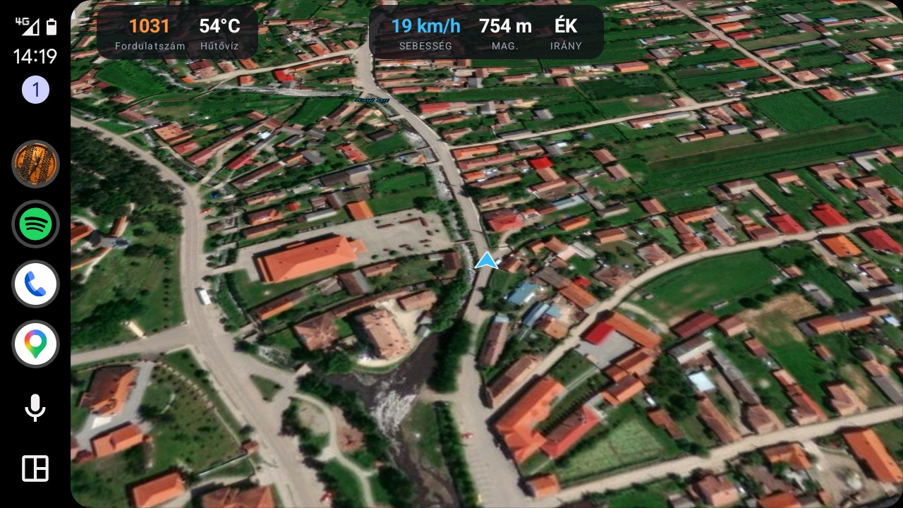
See it in the field
Real screens from real trails.
Ready to hit the trail?
Start free. Upgrade when you're ready.